CounterWatch 3D
3D Modeling and Photogrammetry
Repeatable aerial capture transformed into measurable site records, detailed 3D models and clear spatial context for documentation, planning and reconstruction.
CounterWatch 3D
What This Solution Does
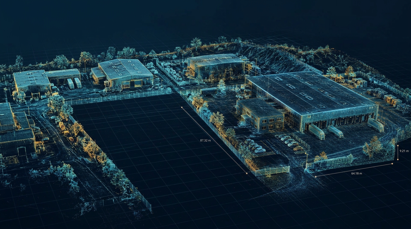
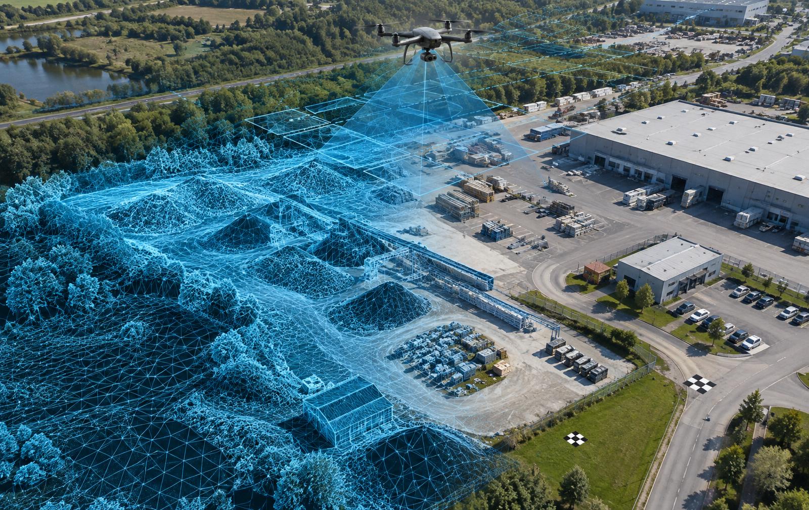
CounterWatch 3D converts coordinated aerial imagery into useful spatial records. Systematic, overlapping photographs can be processed into orthomosaics, point clouds, surface models and textured 3D representations that preserve more context than video and isolated photographs alone.
What It Supports
Baseline site documentation, recurring construction progress, condition comparison, stockpile and earthwork analysis, facility planning, incident scene reconstruction and forensic visualization.
Decision-Driven Deliverables
Outputs are defined around the decision the customer needs to make, not around a single software format.
Comparable Over Time
For recurring programs, consistent flight plans and control methods create comparable records.
Capabilities
What This Solution Includes
Orthomosaic mapping
High-resolution aerial images are combined into a corrected overhead view for site-wide documentation, annotation and comparison.
Point clouds and 3D models
Dense spatial data and textured models provide navigable context for structures, terrain, equipment and surrounding conditions.
Construction documentation
Recurring capture records changing site conditions, visible progress, staging and as-built context across the project lifecycle.
Scene reconstruction
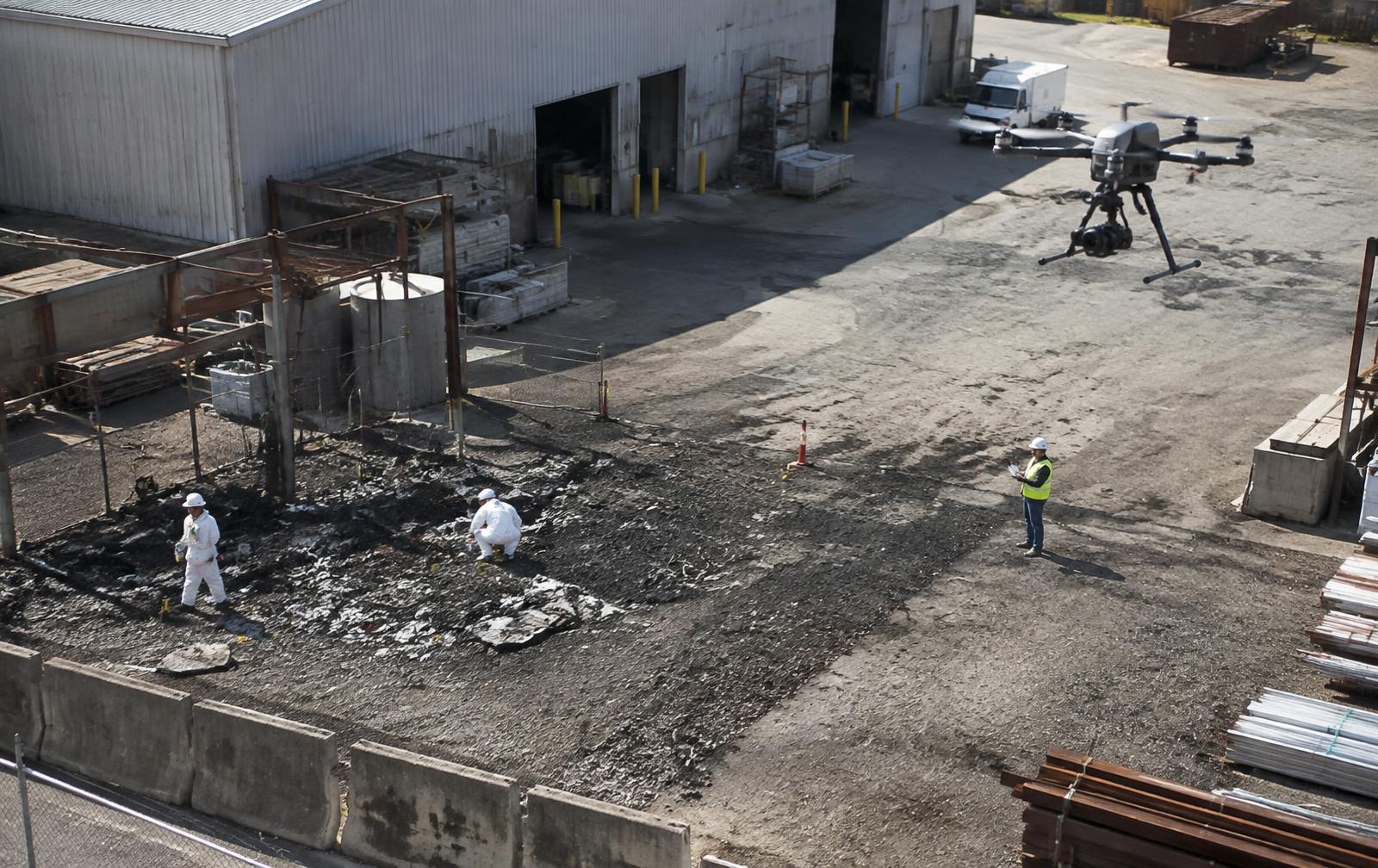
Coordinated aerial and ground imagery can preserve spatial relationships for later incident review and reconstruction.
Forensic visualization
Clear 2D and 3D visualizations can support qualified analysts, investigators, insurers and legal teams in explaining complex site conditions.
Measurement and volume analysis
Appropriately controlled models can support relative distance, area, elevation and stockpile volume analysis within defined accuracy limits.
Delivery
How It Is Deployed
Every program follows a defined sequence so the work is predictable, documented and repeatable across sites.
Define the purpose
Identify the area, decisions, deliverables, required detail, coordinate system, accuracy expectations and repeat-capture needs.
Plan the capture
Design compliant flight paths, image overlap, viewpoints, control methods and ground coordination for the intended output.
Capture and validate
Conduct or coordinate the aerial mission, document field conditions and check imagery for complete, consistent coverage.
Process and deliver
Build and quality-check the agreed outputs, then organize files and visualizations for the customer's planning, review or specialist workflow.
Where It Fits
Environments This Serves
- Construction and capital projects
- Industrial and commercial facilities
- Mining, aggregates and stockpiles
- Crime, incident and accident/loss scenes
- Large or difficult-to-document properties
- Teams needing recurring spatial records
Outcomes
What Changes
- A clear visual record of site conditions
- Repeatable comparison across capture dates
- Measurable spatial context for planning and review
- More effective analysis & communication of complex scenes
Accuracy depends on aircraft, camera, flight geometry, control, processing and site conditions. Unless specifically performed under the responsible direction of a licensed professional, CounterWatch 3D deliverables are for analysis, documentation, visualization and planning support. Aviation, privacy, site-access and evidence-handling requirements are defined for each engagement.
OTHER SERVICES
Drone Security & Autonomous Patrol
Managed and coordinated aerial patrol, event verification, thermal observation, situational awareness and incident documentation.
Airspace Awareness & Counter-Drone Protection
Developing detection, identification, tracking and alert coordination for authorized and unauthorized aircraft awareness.
Drone Inspection & Asset Intelligence
Repeatable visual and thermal inspection programs that help protect the assets and infrastructure inside the perimeter.
Remote Monitoring & Protection Operations
The operational heart connecting people, drones, cameras, trailers, sensors, analytics, alerts and customer communication.
Fixed Surveillance & Video Intelligence
Assessment, planning and integration for fixed cameras, thermal imaging, analytics, sensors and existing surveillance systems.
Mobile Surveillance & Site Protection
Deployable cameras and sensors for construction, events, parking, equipment yards, temporary sites and supplemental coverage.
Site Protection Assessment
A vendor-neutral review of existing infrastructure, blind spots, risks and opportunities, resulting in a phased protection roadmap.
Investigations & Forensic Support
A coordinated transition from live protection into incident review, documentation, evidence considerations and specialist forensic support.
Define the Deliverable
Turn a Site or Scene Into Spatial Context
Tell us what needs to be documented, measured, compared or reconstructed so we can define the right capture and output.